")
")

What's New
Page 7 of 8
IRRIPRO 3.5
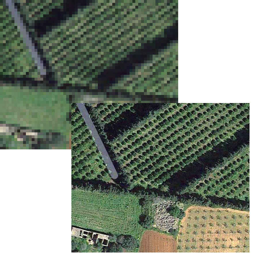 |  |
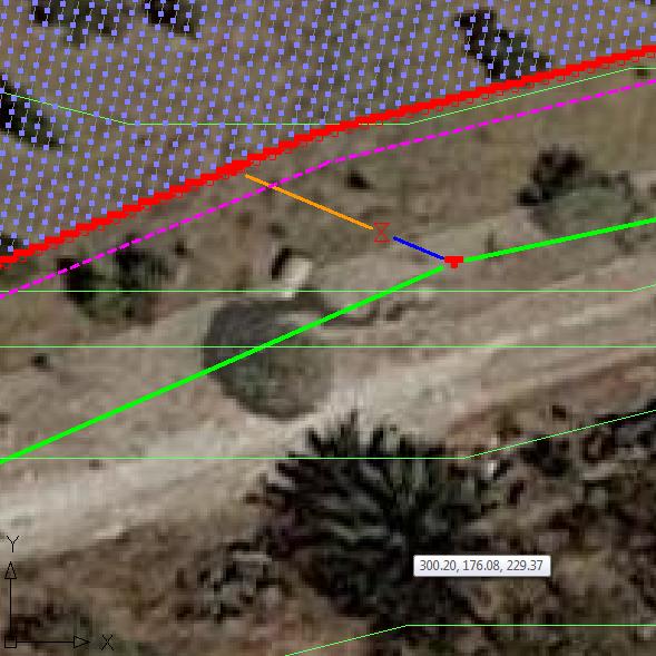
| Satellite images from Google Maps service now available with High resolution (640x640 pixels in previous version, now up to 3600x3600) | Mode of "free drawing" to take action directly in the workspace from scratch and draw all parts of the system (without going through the wizard). Also useful for gardening |
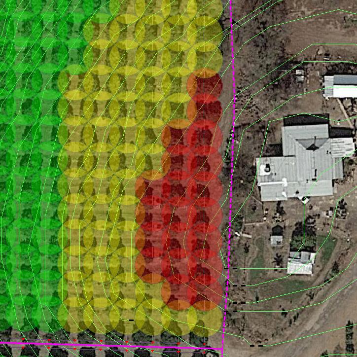 |  |
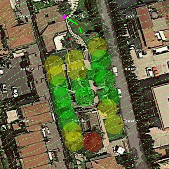
| New rainfall chart with circles wet, to verify overlap and thematic map. Useful for sprinklers / spray for both open field and residential gardening | New design of the elements represented in the editor: bigger sizes for the items for easier identification and new colors for the pipes, according to diameter |
 |  |
| New database structure with many more items and new management system in order to query more features for element and faster than before | New internal management structure of the network: the new model allows you to add, edit, connect, move and delete elements and pipes in a more quick, functional and efficient way |
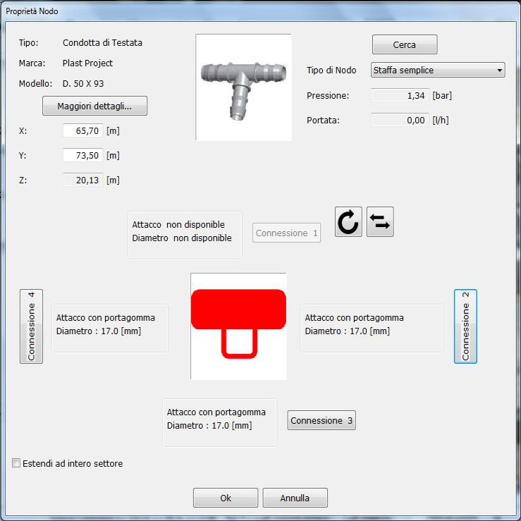 | 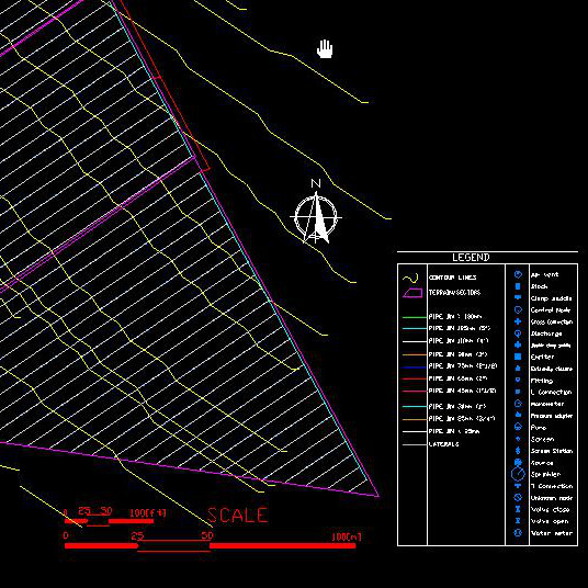 |
| New elements management feature that allows you to organize your connections and fittings. Now they can be used in filters, controllers, accessories and other special parts. Now you can include fittings to complete the network. New management of junctions and layflat | Added legend in the exported CAD file |
 IrriPro is available with