")
")

What's New
IRRIPRO 3.9.10
 | 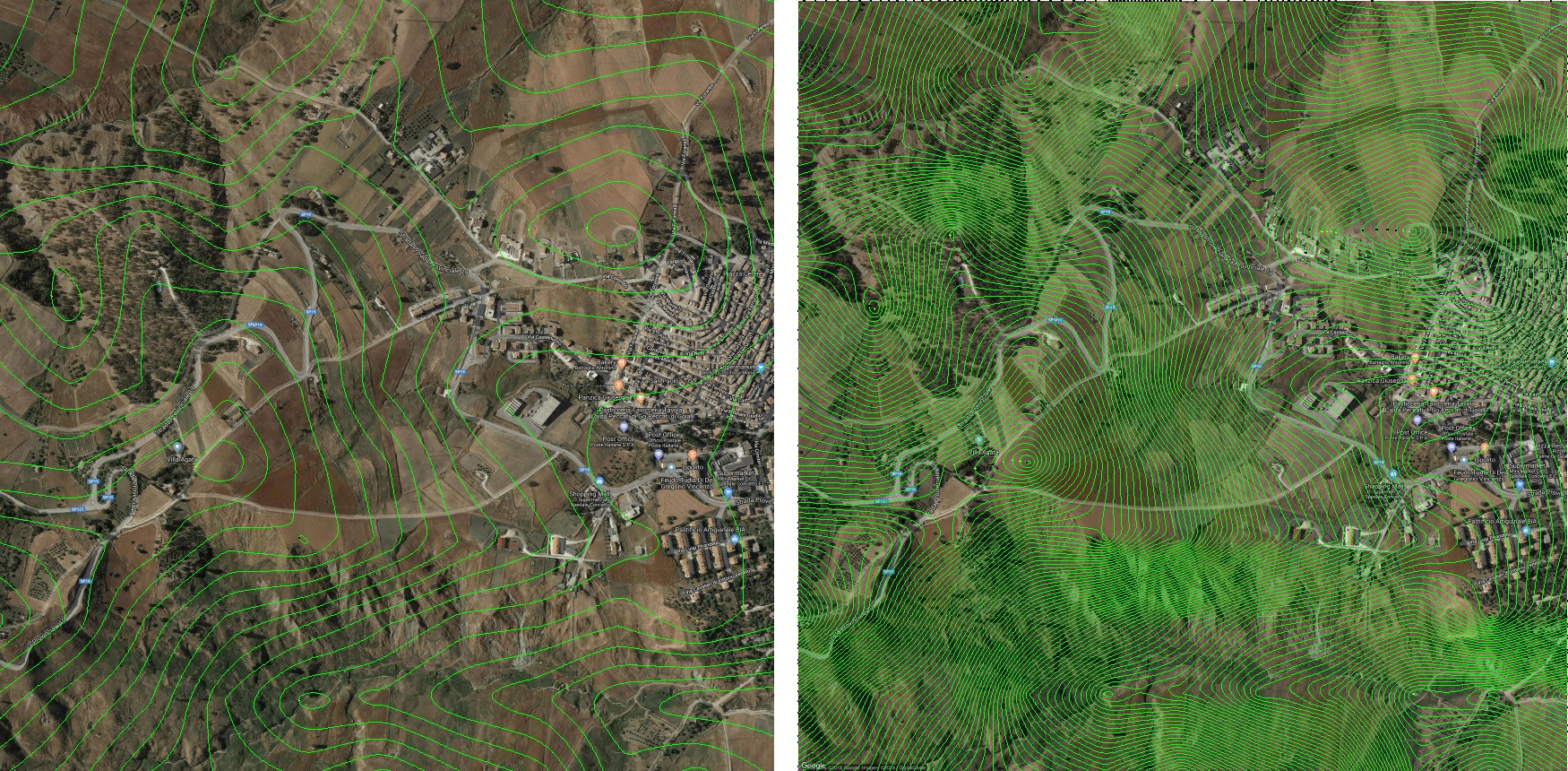 |
Import of Kml and Kmz files with simultaneous import of the color graphics contained in the file, elaboration of the survey and the satellite image relative to the GIS position. | Choice of the equidistance value of the contour lines before the survey. In the international system it is possible to choose between the values of 1, 2, 5, 10 and 25 meters, while in the US and UK systems between 2, 5, 10, 25 and 50 feet. |
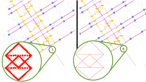 | 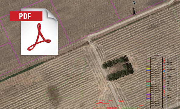 |
| New vector symbols of the graphic elements (for a quality representation at any zoom) with the possibility to change the size from preferences. This allows you to manage the elements with the freedom to use large symbols in the case of large areas where a larger representation is needed, and smaller symbols in the case of small systems where they avoid overlapping in areas with greater concentration of elements. | New PDF export in vector quality where the elements and pipelines are represented in scale and in professional quality for a print in any dimension including legend, label, information table. Possibility to hide layers from the work area. Click here to download and open a sample PDF file exported with IrriPro. |
 | 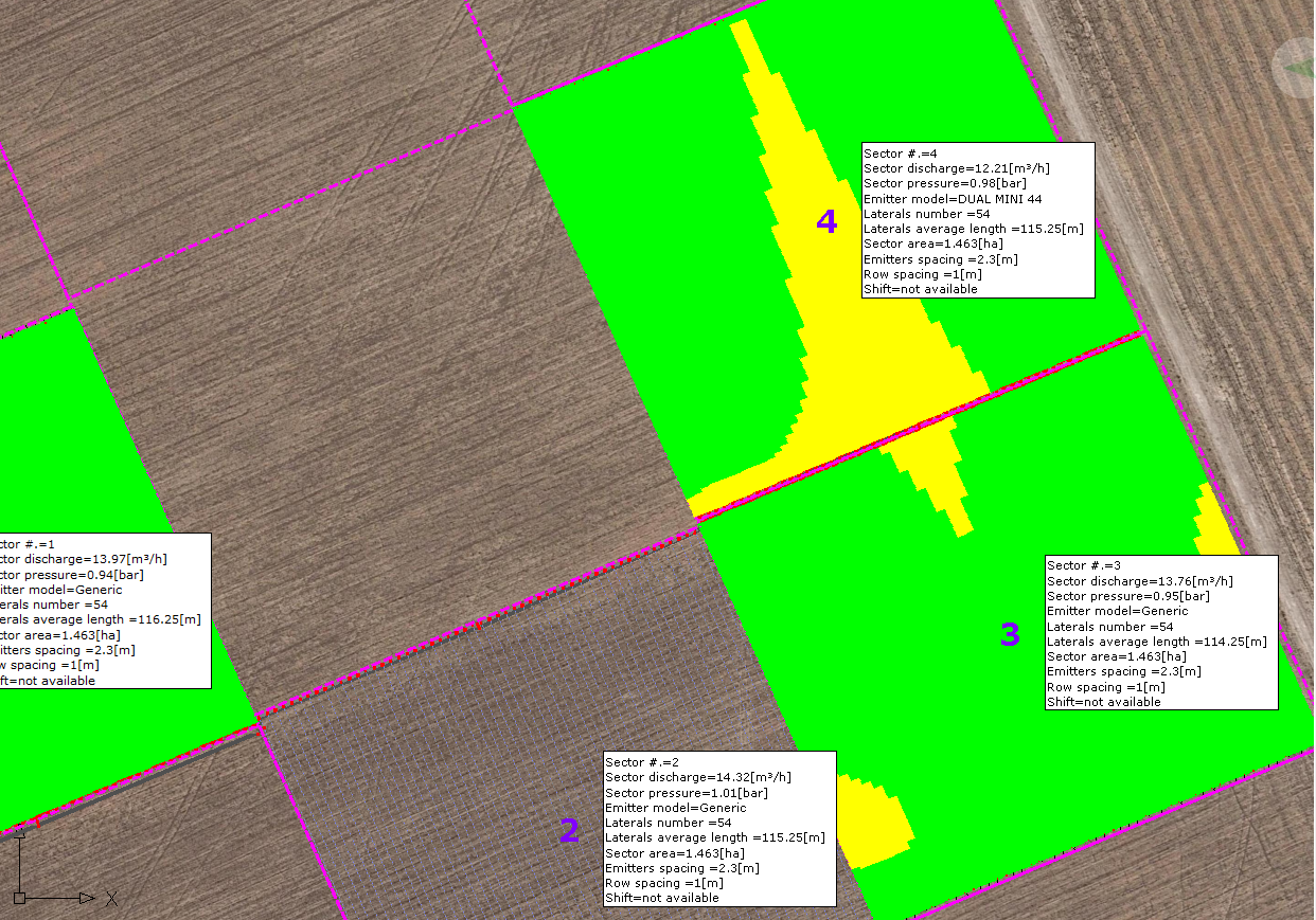 |
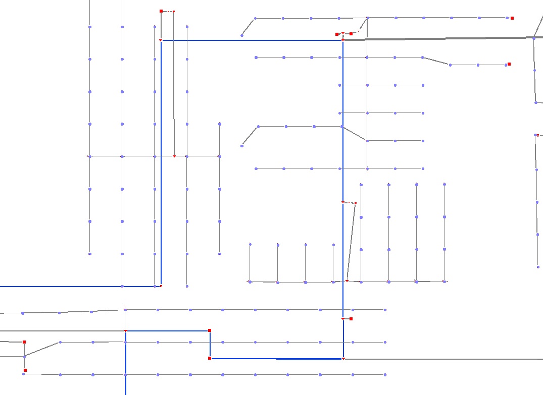
| New zooming function with the mouse: now you can easily move and zoom parts of the plant or part of the land simply by using the mouse wheel. | Work area with new legend (which can be moved to any position) and new information tables per sector where area, emitter model, number and length of lateral pipes, flow/pressure, emitter spacing, row spacing and shift are reported. |
 |  |
| Improvements for different functionalities: CAD file import, label management, area and rainfall intensity calculation, area division (for concave shapes), CAD file export (with new legend, symbols and layers). Click here to download and open a sample CAD file exported with IrriPro. | Substantial database update with more than 6000 products added or modified, with data adjustments and image enhancement. Now you can view product images with a maximum resolution preview. |
 | 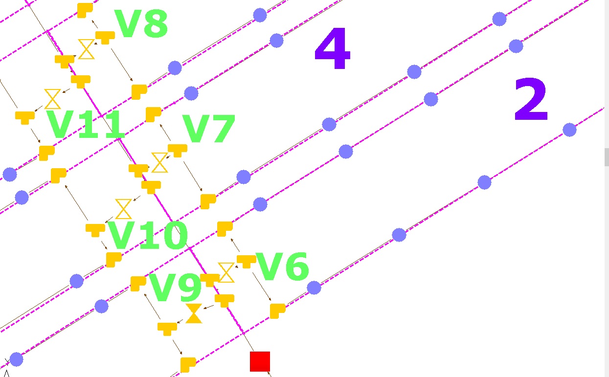 |
The application has been optimized and the features improved to design greater systems faster and to cover more easily big areas. For example, once the area has been splitted into many parts, it's possible to assign / select (through the area of influence) the sector and to have automatically filled the angle value (the measurement performed on the working area is moved to the windows and / or on the wizard). | Automatic label insertion for valves and sectors. An internal algorithm automatically displays the sector and valve number according to the general index of the elements and the insertion position. A valuable help for identifying the element and work on it. |
 | 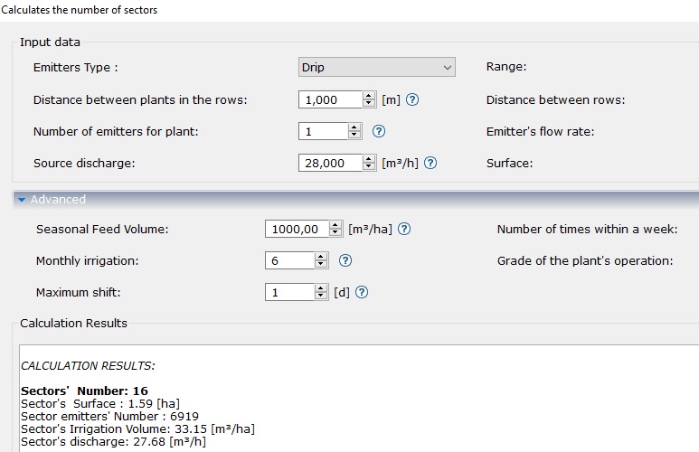 |
| "Divide Area" feature to divide an existing area into equal parts by defining one or two directions. Thanks to this new functionality, each area can be divided into sectors, to then build the system inside them. Now a new procedure allows you to quickly assign a part of area to the sector during the wizard. | "Calculates the number of sectors" function to calculate, based on the available discharge of the source, on the surface, on the type and distribution of the emitters, etc.. the number of sectors in which to divide a surface. Other parameters (including needs of the crops) are used to extimate the number and duration of the shifts. |
 | 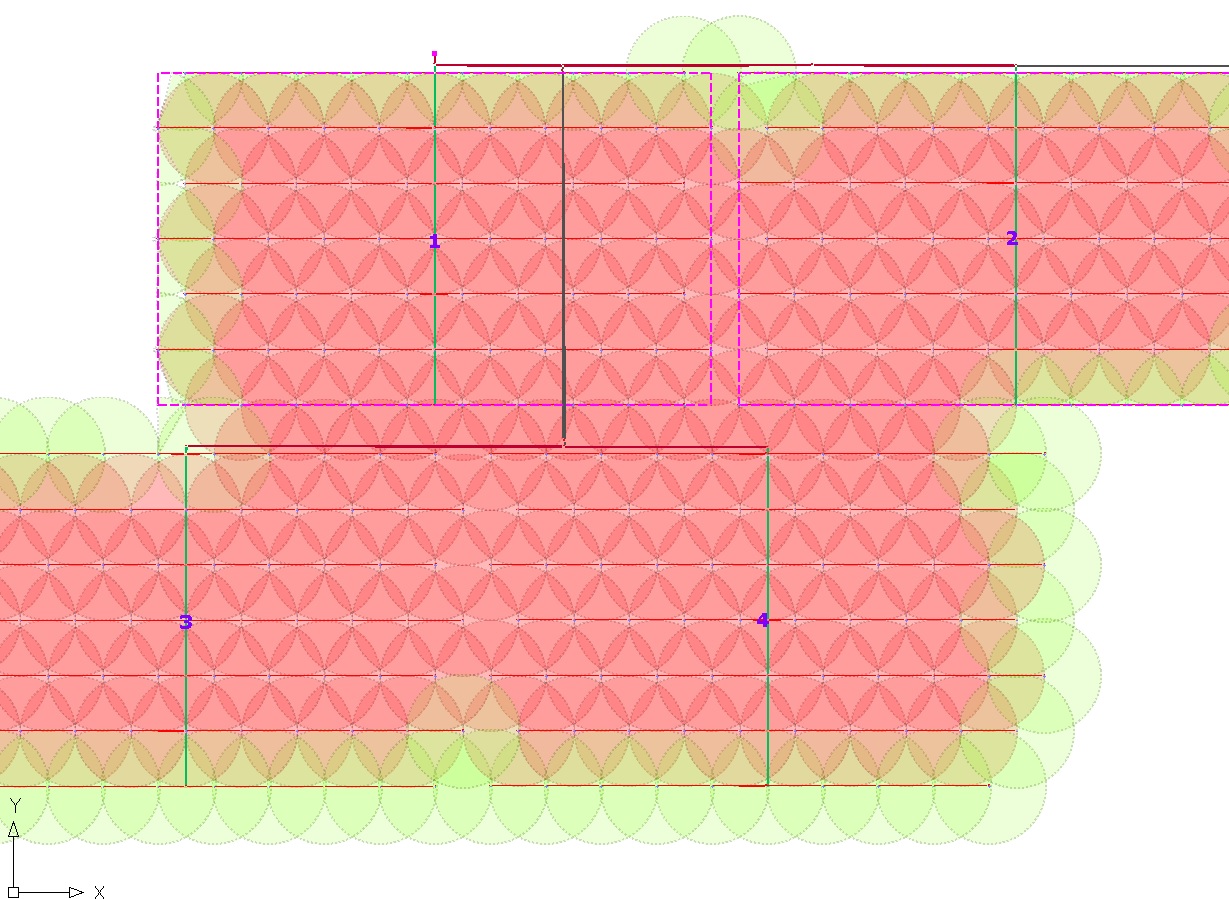 |
| Different color assignment for each sprinkler model. It allows an immediate identification of the models and the places where they are used. | Possibility to define the models of the perimeter sprinklers, even in the case of more adjacent sectors. Entering the sprinkler property, it is possible to indicate whether to extend to the perimeter of the sector or of the entire plant a different model from the others. |
 |  |
| A new text editor to insert text or modify the existing one, by color, orientation, font and size. It is also possible to intervene on the labels. Text and labels can be managed with a dedicated layer. | Color indication of pipes under pressure (water path) once the hydraulic calculation is performed: the pipes different from the gray color will be under pressure. |
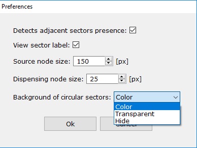 | 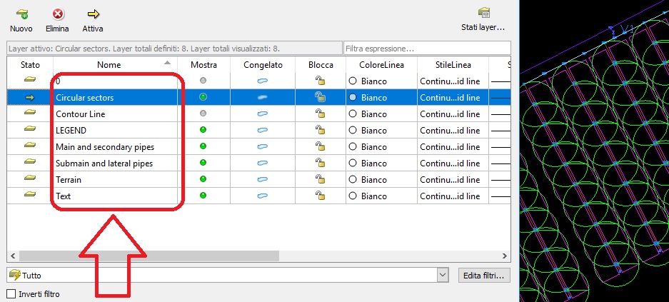 |
| New preferences window to manage the following aspects: transparency sprinkler / popup coverage circles, enable / disable the continuity of sprinkler / popup circles on the borders of the terrains in adjacent sectors, to change the size of emitters and source. | Importing of the CAD file with text and colors. The exported CAD file now has new layers for main + secondary pipelines, submains + laterals and one dedicated to sprinkler circles and text. |
 IrriPro is available with