")
")


IrriPro 3.5 beta in test phase
- Hits: 14520


- 29 Aug

Irriworks is proud to announce the new IrriPro 3.5 in Beta version. Once the next step of testing will be completed the new release will be available to all.
Below is a list of new features and enhancements introduced in the new version of IrriPro.
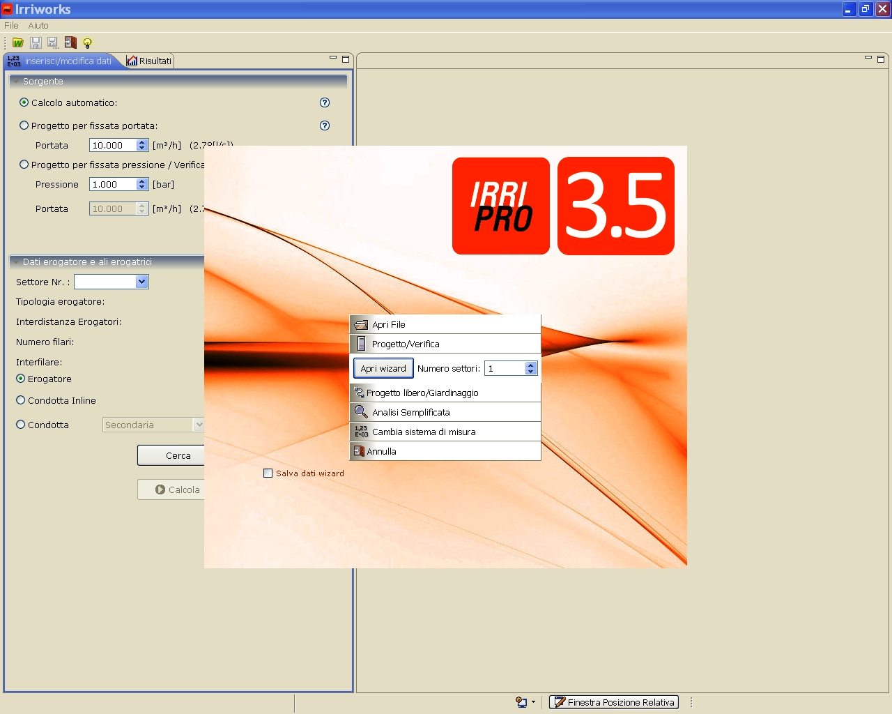
NEW FEATURES
NEW FEATURES
- Satellite images from Google Maps service now with High resolution (640x640 pixels in previous version, now up to 3600x3600)
- Mode of "free drawing" to intervene directly in the workspace from scratch and draw all parts of the system (without going through the wizard). Also useful for gardening.
- Introduced UK and US systems of measurement: in addition to the SI international system, added capital US and imperial UK systems.
- New IrriPro version for MAC systems
- New structure of the file saved to hold more information and be more compressed (WARNING: new format .iwsx excludes compatibility with the previous format .iws)
- New database structure with many more items and new management and research system to learn about more features for element and faster than before
- New internal management structure of the network: the new model allows you to add, edit, connect, move and delete elements and pipes in a more quick, functional and efficient way.
- New elements management feature that allows you to organize your connections and fittings. Now they can be used in filters, controllers, accessories and other special parts. Now you can include fittings to complete the network. New management of junctions and layflat.
- New pluviometric chart with circles wet, overlapping and thematic map. Useful for sprinklers/spray for both open field and residential/gardening.
- New design of the elements represented in the editor: bigger sizes for the items for easier identification and new colors for the pipes, according to diameter
- New feature to insert emitters and pipes with generic characteristics directly on the working area
- Add legend in the exported CAD file
- New feature to quickly move the source to any point of the workspace
- Rewritten and improved the functionality of the "relative position window" with which you can now perform operations of moving nodes or network parts, or design pipelines entering Cartesian or polar coordinates. This console design will be operational even when using another function of design or when zooming or panning.
- Possibility to insert multiple emitters at the same delivery point
- Added French language
IMPROVEMENTS
- Improved speed of calculation and design of the hydraulic network
- Rewritten the code of much of the program in order to improve execution efficiency, compatibility with multiple operating systems (new DB structure) and creation of a new smaller installation file (120 MB)
- Opening program faster
- Improved the functionality of snap to the grid or to network elements
- Improved execution speed of many features in the working area (particularly moving / rotation / insert / design elements)
- Improved automatic design of the network that is able to cover more completely the terrain by better filling the sectors for both classical and symmetrical shape.
- Opening / closing valve directly from the contextual menu
- Ability to copy / cut and paste the terrain (sector boundaries)
- Ability to copy / cut and paste whole sectors (terrain + network), or parts of them. To draw a network made of different equal sectors, just create one and replicate it as many times as you want. The new sectors created will be connected in a second time
- Ability to copy / cut network elements and the terrain in an editor and paste them into another
FIXED BUG
- Fixed major problem with Google Maps for high-resolution screens
- Fixed several bugs to improve stability and performance capabilities.
If you are interested in the program beta-tester and try the preview of new version 3.5 please contact us at This email address is being protected from spambots. You need JavaScript enabled to view it. to request a free license temporarily. Each contribution in report errors and bugs will be appreciated and will allow to Irriworks to provide a better product.
 IrriPro is available with
 IrriPro has a CAD-style user friendly interface, designed to be used by engineers, agronomists and other technicians. They have all the analisys tool needed to estimate the consequences of any design choice and to represent the trend of any physical parameter.
 The DB is not a list of passive elements, but a way to make the most of the software using existing material on the market.